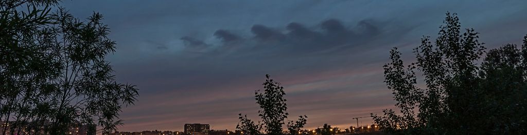
Kelvin-Helmholtz cloud
An extremely rare phenomenon, where a cloud produces a billowing wave pattern. They occur when there is a strong vertical shear between two air streams, causing winds to blow faster at the upper level than at the lower levels.
- Height of base: Can be any height, but usually at higher levels.
- Shape: A repeating breaking wave pattern.
- Latin: These clouds are named after Hermann von Helmholtz and William Thomson, Lord Kelvin, physicists who studied turbulent airflow. There is no Latin etymology.
- Precipitation: None.
What are Kelvin-Helmholtz clouds?
Resembling evenly spaced rolling ocean waves, Kelvin-Helmholtz are one of the most striking and rare cloud types.
How do Kelvin-Helmholtz clouds form?
They occur when two different layers of air in our atmosphere are moving at different speeds (a phenomenon known as shear). When the upper layer of air is moving at a higher speed than the lower-level air, it may scoop the top of an existing cloud layer into these wave-like rolling shapes.
Kelvin Helmholtz instability is a scientific phenomenon not exclusively associated with clouds. It can occur wherever there is a velocity difference across the interface between two fluids. The most obvious example is wind blowing over water, in which fast-moving air can create the waves on the slower-moving water.
What weather is associated with Kelvin-Helmholtz clouds?
The clouds are more likely to occur on windy days. They are often good indicators of aircraft turbulence.