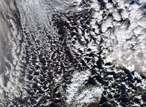
Cumulus clouds
The fluffy, cauliflower-shaped cumulus is one of the most common and distinctive types of cloud. All cumulus clouds develop as a result of convection.
- Height of base: 1,200 - 6,500 ft
- Shape: cauliflower of fluffy
- Latin: cumulus - heap
- Precipitation: occasional rain or snow showers
What are cumulus clouds?
Cumulus clouds are detached, individual, cauliflower-shaped clouds usually spotted in fair weather conditions. The tops of these clouds are mostly brilliant white tufts when lit by the Sun, although their base is usually relatively dark.
How do cumulus clouds form?
All cumulus clouds develop because of convection. As air heated at the surface is lifted, it cools and water vapour condenses to produce the cloud. Throughout the day, if conditions allow, these can grow in height and size and can eventually form into cumulonimbus clouds.
Along coastlines, cumulus may form over land during daylight hours as a sea breeze brings in moist air, which is then warmed by the surface. This effect reverses overnight as the sea becomes warmer than the land and cumulus form over the sea.
What weather is associated with cumulus clouds?
Mostly, cumulus indicates fair weather, often popping up on bright sunny days. Though if conditions allow, cumulus can grow into towering cumulus congestus or cumulonimbus clouds, which can produce showers.
How do we categorise cumulus clouds?
Cumulus clouds have four main categorisations or 'species':
- Cumulus humilis - these are wider than they are tall, often numerous in the sky and indicate fair weather conditions
- Cumulus mediocris - these are as wide as they are tall and are usually seen amongst a variety of other cumulus variations
- Cumulus congestus - these are taller than they are wide, looking like long chimneys capable of producing light showers
- Cumulus fractus - these are the broken remnants of cumulus clouds that are breaking up or 'dissipating.'