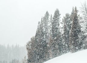
Snow forecasting in the UK
For most of us it’s usually pretty exciting to see snow in the UK, because it doesn’t happen all that often. The reason for this is that we are surrounded by relatively warm seas, which can often keep our temperatures up.
In winter, the land gets cold more quickly than the sea, so where there is a lot of land and very little sea, such as the huge interior of continental Europe, Canada or the United States, it gets cold enough for snow to fall frequently. However for the UK, being an island surrounded by the milder water, the air can often warm up slightly before it reaches our shores, and we often see rain rather than snow, or, even trickier to forecast; a mix of rain, sleet and snow.
What do we need for snow to fall in the UK?
Essentially, we need the air to be cold enough, and a supply of moisture. Let’s tackle the cold bit first.
To get cold air across the UK we need winds from the north or east. Northerly winds (i.e. air travelling from north to the south) bring the air straight from the arctic and over a cold sea to reach the UK. In winter, easterly winds (i.e. travelling for the east to the west) are cold because they arrive from the cold continental interior of mainland Europe. However, there is another way which requires very little wind at all - high pressure that becomes established across the UK for a long time in winter. Provided that skies are clear, temperatures can fall gradually day-on-day because the sun is weak and there is little cloud to keep in any heat at night. The most common wind direction in the UK is south-westerly though, so more often than not we get relatively mild air from the Atlantic bringing rain, rather than this cold air from the north and east which often turns any rain to snow.
What about the moisture? Often with the cold easterly winds, and the air travelling over so much dry land, there is very little moisture in it to form the snow and we end up with some crisp winter sunshine instead. We either require the cold air to meet a rain-bearing weather front and turn it into snow, or for the cold air to pick up enough moisture from its short journey across the North Sea, to form showers. There are also the effects of air rising up hills and mountains. As it’s usually colder higher up in the atmosphere, when the air rises up the hill, it becomes colder, and condenses to form cloud and precipitation. The precipitation will either be rain or snow, depending on just how cold the air is, and where the “freezing level” is.
What is the freezing level?
Often we can see the hilltops covered in snow, but none at ground level. That is because the air at the top is cold enough for snow, but the air at the bottom is too warm and the snow melts to bring sleet or rain. This is what weather forecasters call the “freezing level” - the part of the atmosphere where the air temperature is at 0 °C. This can be as low as 200ft or so above sea level on some days – so it wouldn’t just be the tops of the hills that would get snow, many towns and cities are higher than 200ft above sea level. Check the altitude of your town to see if you would have seen rain or snow on this occasion (so if you live above 200ft above sea level, you would have seen snow on this day, if you live below 200ft then you would have seen rain).
Why is snow forecasting in the UK difficult?
As it’s so cold high up in the atmosphere, most precipitation either starts off as snow or supercooled raindrops. As it falls to earth, it moves through warmer air most of the time and melts. Depending on the temperature of the air near the ground we either see rain or sleet or hail. However, the freezing level (usually the boundary at which precipitation will fall as snow rather than rain) doesn’t just stay the same every day, or even within a day, sometimes it can change hour by hour, across the country, or even a few miles down the road.
There are several things forecasters look at to predict how low down the precipitation will fall as snow:
- Where the air has come from - if the air has come from a slightly different direction, say for example if it has spent a slightly longer time travelling over mild water, then the air can be ever so slightly warmer, and therefore the freezing level would be slightly higher up.
- Very heavy precipitation - Even if the freezing level is quite high up in the air, it turns out that really intense precipitation can drag the “freezing level” nearer to the ground, and keep any precipitation falling as snow lower down too. Prolonged, heavy rainfall can therefore turn to snow.
- When warm air meets cold air – this is the most difficult situation to predict snow. Weather fronts mark the boundary between cold air and warm air, so when a weather system moves in, there will be warm air and moisture wrapped up in it. While we need the moisture for snow to form, the warm air makes it very tricky to forecast if it will be turning to rain. As the warm air bumps into the cold air, it slides up over the top (warm air rises). The precipitation falls into the colder air lower down, but in time the air mixes together and makes the cold air slightly warmer, and the warm air slightly colder, and so then rain becomes more likely. You’ll often find that there’s a fine line between who sees snow and who sees rain. Sometimes a fraction of a degree is the difference between rain and snow. That’s what makes forecasting snow difficult (and often frustrating!).