Named storms and low pressure systems in the UK
What is low pressure? It is a type of weather system which brings cloud, wind and rain to the UK. If the low pressure system is intense enough, it may become a named storm.
What are low pressure systems?
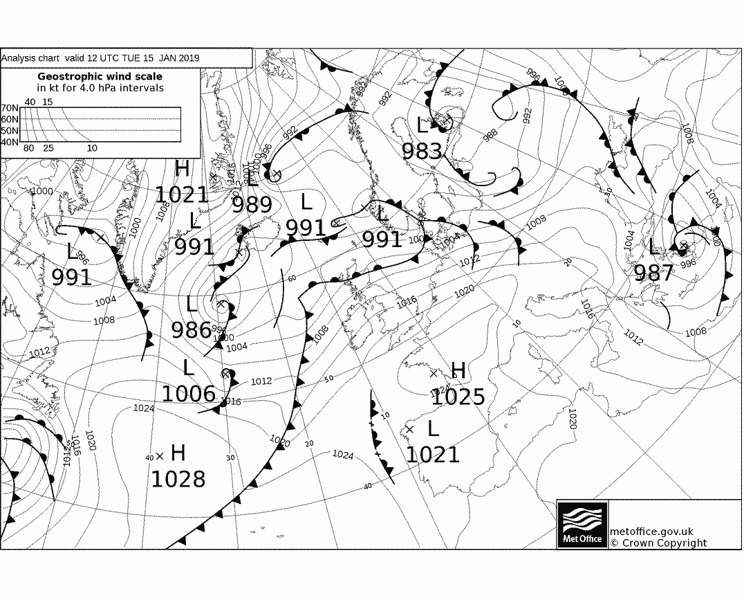
Throughout the year, low pressure weather systems frequently move across the UK, and these tend to bring cloud, rain, and windy weather. They usually consist of a ‘warm front’ a ‘cold front’ and an ‘occluded front’, in the shape of a triangle.
However, as you can see from the weather chart below, it is often much more complicated in reality.
You can find out more about weather fronts by clicking here.
Why do low pressure systems form?
The UK is at just the right latitude where cold polar air from the north meets warmer tropical air from the south, and it is along this boundary that the jet stream flows. The jet stream is a band of strong winds high up in the atmosphere (usually around the cruising altitude of aeroplanes). These strong winds in the jet stream‘steer’ low pressure systems around the globe.
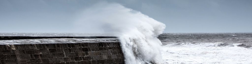
The difference in temperature between the polar air and tropical air tends to be at its greatest during Autumn and winter, and this can lead to a stronger jet stream forming, and this can sometimes intensify low pressure systems, bringing stronger winds and heavier rain.
If the low pressure system looks to bring significant impacts to the UK, it may become a named storm.
How do low pressure systems form?
The UK is at just the right latitude where cold polar air from the north meets warmer tropical air from the south, these cross at what is commonly referred to as the polar front. Above the interface of the polar and tropical air masses a stream of strong wind is formed, known as the jet stream.
Atmospheric jet streams consist of bands of strong winds, reaching up to 200 mph. These bands can be found above the Earth's surface between 9 and 16 km (at about the cruising altitude of a commercial aeroplane) and can move weather systems around the globe. In winter, the jet stream separates cold, Arctic air masses from warmer large-scale tropical air masses of the mid-Atlantic. The location of a jet stream varies within the inherent fluctuations in the environment.
The storms mostly form in the winter months when the temperature differentiations between the polar and tropical air masses are at their greatest. This brings about a fortification of the jet and causes the polar front to become unbalanced, which in turns allows large disturbances in the form of vortices or cyclones to form.
These instabilities can give rise to waves or disruptions along the jet stream, which can cause the formation of Atlantic depressions to further deepen at the surface as they are steered towards the UK, so they are significant to the UK's weather and to meteorologists.
The strong winds of the jet stream within the upper atmosphere, remove and replace rising air from the Atlantic more rapidly than the air is replaced at lower levels, and therefore reduces the pressure in the centre of the cyclone. This larger-than-normal pressure gradient at the Earth's surface produces the strong wind component of the winter storm. In turn, heavy precipitation is created by the clashing of the two differing air masses. On a more localised scale strong gusts and even thunderstorms can be produced, especially in the areas where the updrafts are particularly strong.
The deep low pressure systems, that are comparatively widespread over the North Atlantic, frequently track past the north coast of Britain and Ireland and on into the North and Norwegian Seas. However, they can sometimes track at lower latitudes where they can affect almost any country in Europe.